 Weather is the state of the atmosphere at any given time. The American Meteorological Society’s Glossary of Meteorology says, “Weather consists of the short-term (minutes to days) variations in the atmosphere.”
Weather can be thought of as temperature, humidity, precipitation, cloudiness, visibility, and wind. Various types of weather can occur, which include but are not limited to thunderstorms, tornadoes, liquid precipitation (e.g., rain), freezing precipitation (e.g., freezing rain), and frozen precipitation (e.g., snow).
In other words, when you look out your window, you observe the weather because you see what is happening at that specific time. Mark Twain once said, “If you don’t like the weather in New England now, just wait a few minutes.”
A meteorological winter includes December, January, and February. This is based on annual temperature cycles and the calendar. Winter weather events can include different types of storms and precipitation.

 Different Kinds of Storms & Precipitation
The National Oceanic and Atmospheric Administration (NOAA) National Severe Storms Laboratory defines a winter storm as a combination of heavy snow, blowing snow, and/or dangerous wind chills. Winter storms include blizzards, ice storms, snow squalls, and snowstorms (e.g., lake-effect storms).
Blizzards are a combination of wind and blowing snow that results in very low visibility. Heavy snowfalls and severe cold are not required for an event to be called a blizzard, but they can accompany it.
Ice storms accumulate at least 0.25 inches of ice on surfaces, creating hazardous walking and driving conditions.
Snow squalls are brief, intense snowfall with strong, gusty winds.
A variety of snowstorms affect New York State. A research study determined that 11 different snowstorm types can contribute to snowfall in Central New York alone. These include lake-effect snowstorms, clippers, Colorado lows, frontal storms, Great Lakes lows, Hudson lows, Nor-easters, Oklahoma hooks, Texas hooks, tropical cyclones, and upper air disturbances.
Out of the 11 types, lake-effect storms contribute the mos
 t seasonal snowfall totals. Lake-effect storms occur as a cold air mass moves over a warm body of water, like Lake Ontario.
As the cold air moves over the waterbody, warmth and moisture are moved into the lowest portion of the atmosphere, or closest to the ground. Unlike Nor’easters in the Atlantic coastal regions, these storms do not form from low-pressure systems.
Types of winter precipitation include snow, sleet, and freezing rain. Hail is often a misconception of winter precipitation. Hail is precipitation in the form of hard, rounded pellets or irregular lumps of ice and is produced in large cumulonimbus clouds, which are clouds that produce thunderstorms.
While uncommon at times, graupel is a type of winter precipitation that is often confused with hail. Graupel is precipitation in the form of white, opaque ice particles and is also referred to as snow pellets.
Sleet forms when snow falls through a shallow layer of warm air, then a layer of freezing air, and reaches the ground as frozen raindrops that bounce on impact.
This essay was excerpted (with minor editing) from the Tug Hill Commission‘s How Winter is Changing in the Tug Hill Region (March 2025).
Learn more about the weather in New York State.
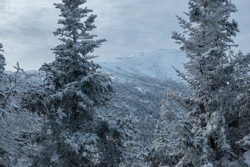
Illustrations, from above: The Adirondacks in Winter; Mean annual snowfall (in inches) for Upstate New York, using 1991-2020 climate normals; and average seasonal snowfall totals for areas impacted by lake-effect snow – including Tug Hill – in New York (in inches) (National Weather Service – Buffalo).

